
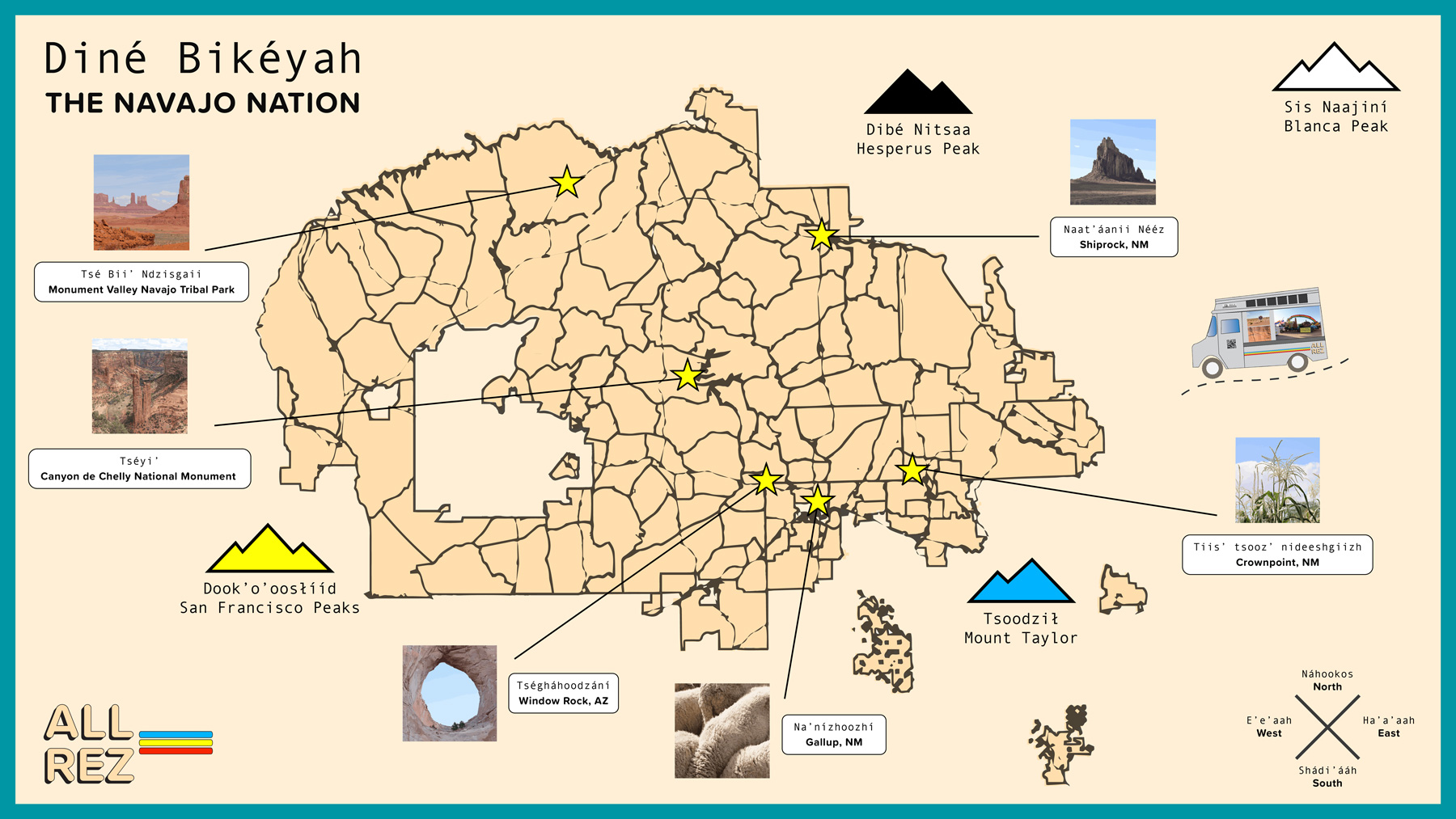
NN-Map_ALL-REZ_web
A map of Diné Bikéyah (the Navajo Nation), on a beige background framed by a teal border. The words “DINÉ BIKÉYAH / THE NAVAJO NATION” are in the top left corner, and there is a compass in the bottom right corner, which states “NÁHOOKOS / NORTH,” “HA’A’AAH / EAST,” “SHÁDI’ÁÁH / SOUTH,” and “E’E’AAH / WEST.” In the bottom left corner are the words “ALL REZ.” The shape representing the land is beige, with a black border surrounding it, as well as additional black borders demarcating different sections of the land. Six specific locations are highlighted through the addition of yellow stars, each with a line radiating from it, connecting it with a photograph and an accompanying caption. These captions read: “TSÉ BII’ NDZISGAII / MONUMENT VALLEY NAVAJO TRIBAL PARK,” “NAAT’ÁNII NÉÉZ / SHIPROCK, NM,” TIIS’ TSOOZ NIDEESHGIIZH / CROWNPOINT, NM,” “NA’NÍZHOOZHÍ / GALLUP, NM,” “TSÉGHÁHOODZÁNÍ / WINDOW ROCK, AZ,” and “TSÉYI’ / CANYON DE CHELLY NATIONAL MONUMENT.” Additionally, there are four symbols representing mountains, and an icon representing a stepvan driving on a road. The captions for these mountains read: “DIBÉ NITSAA / HESPERUS PEAK,” “SIS NAANJINÍ / BLANCA PEAK,” “TSOODZIŁ / MOUNT TAYLOR,” and “DOOK’O’OOSŁÍÍD / SAN FRANCISCO PEAKS.”